TEI’S UTILITY LOCATING SERVICES
- Ground Penetrating Radar (GPR)
- Using Utility and Structure Scan equipment from GSSI, the leader in GPR technology
- Electromagnetic Line Locating (EMLL)
- Conduction and ring clamp induction methods using the RD8100, Radiodetection’s most advanced high-precision cable locator
- Electromagnetic Locating (EM)
- Metal detection for confirmatory scanning using the Fisher Gemini 3
- Sonde technology for non-metal utilities
- Auto-CAD, Vectorworks, GIS and Google Earth utility mapping available
Common reasons for performing utility locating include:
- Utility detection - locate metallic and non-metallic utilities
- Locating underground storage tanks (USTs)
- Environmental assessment
- Damage prevention
- Geological investigation
- Forensics
- Scanning prior to digging, trenching, conducting site assessments and mapping
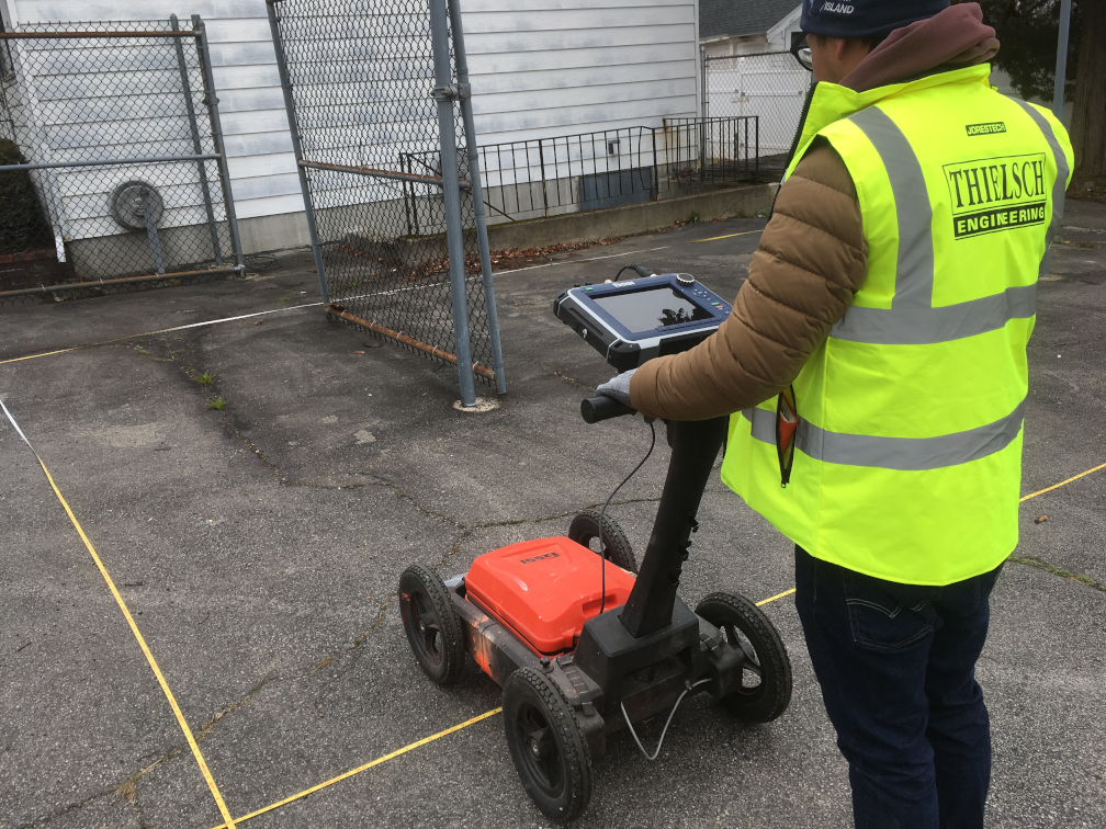
GPR FOR UTILITY LOCATING
Ground Penetrating Radar (GPR) is the most thorough method when locating utilities. By using GPR, TEI is able to map out virtually all utilities and other obstacles, giving our clients a clear picture of their project site’s subsurface.
GPR allows TEI to locate both metal and non-metal utilities with real-time visuals. With this information, we are able to instantly relay approximate locations and depths of subsurface utilities and structures to our clients at the time of scanning.
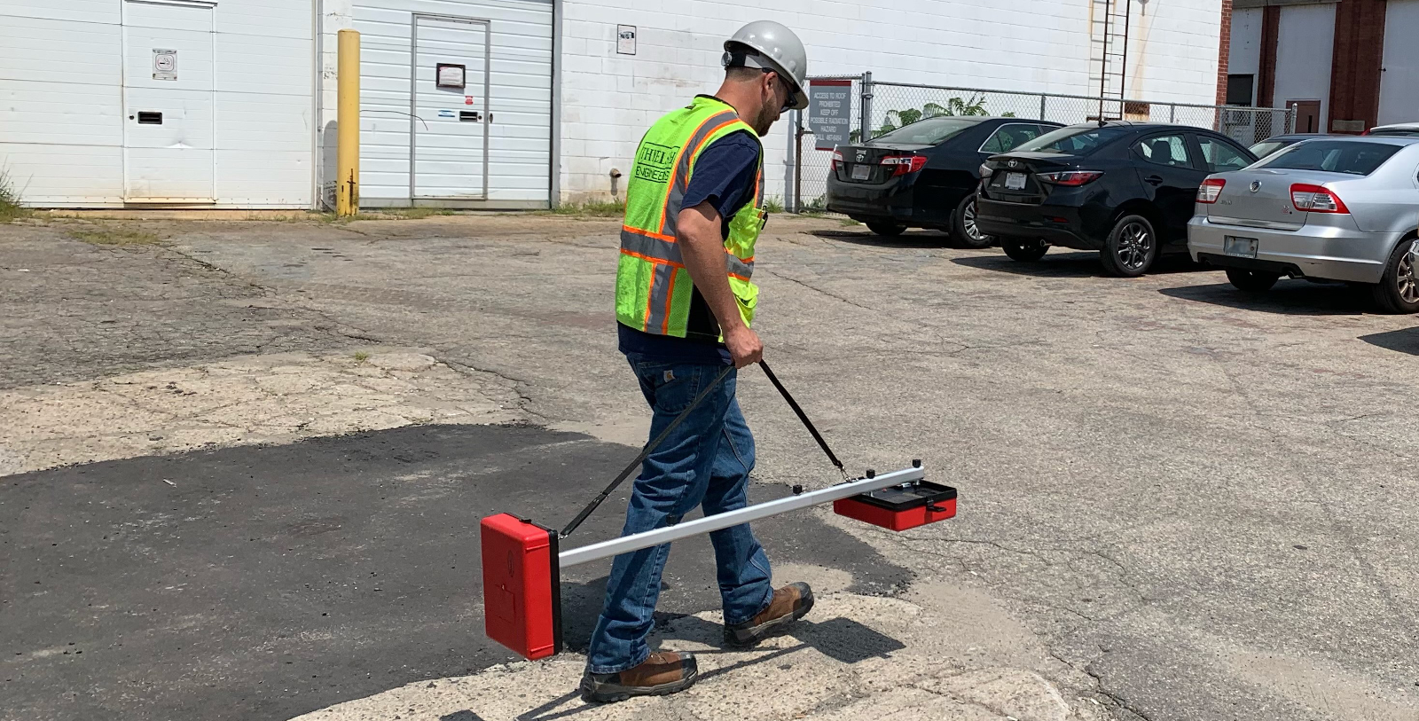
EMLL FOR UTILITY LOCATING
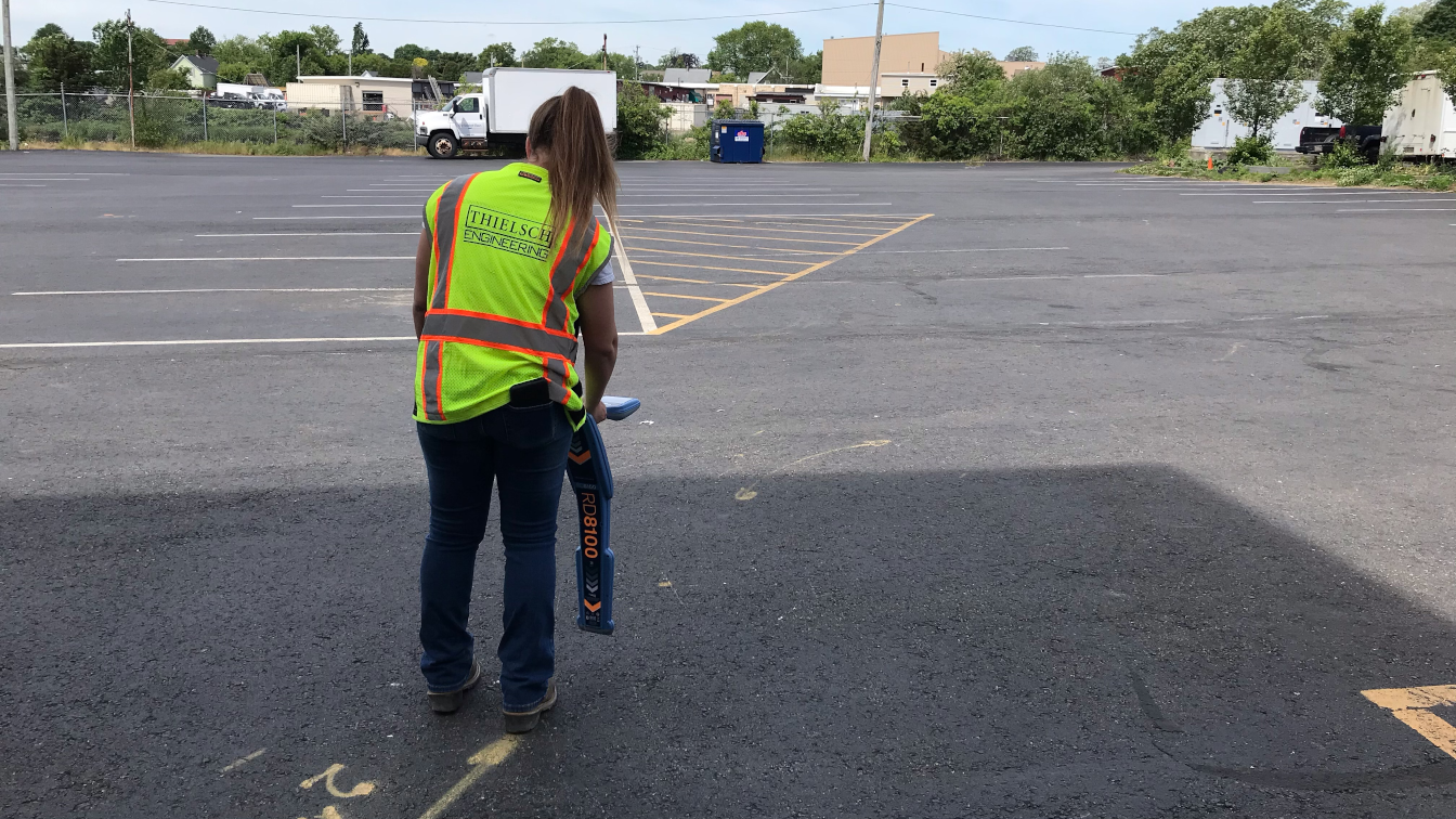
TEI uses Electromagnetic Line Locating (EMLL) methods in conjunction with GPR to get a more accurate picture of what is below the surface. EMLL allows us to confirm the presence of metal USTs and pipes below the surface. EMLL methods are used for the location of underground metallic pipes and the detection of buried pipes and cables.
EMLL is a faster and more traditional method of locating utilities. EMLL requires no ground contact and is useful when scanning areas with dense brush or other obstacles. One person can collect as many as 10,000 data points per day using EMLL methods. EMLL is the most useful when there are visual surface features and utility access points.
TEI uses a variety of EMLL equipment to ensure our clients get the best and most accurate results. Between radio frequency, electromagnetic induction tools, and metal detectors, TEI is able to handpick the right equipment to get the job done.
FIELD MARKING
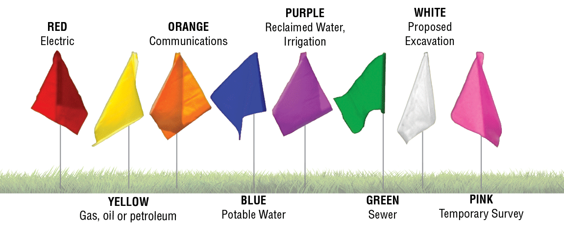
TEI personnel adheres to all DigSafe and Call Before You Dig protocols, and field mark utilities using the universal color coding system. See graphic below for universal color coding system.
MEMBERSHIPS
Thielsch Engineering, Inc. is an active member in the National Utility Location Contractors Association, and all personnel have been trained to these national standards.